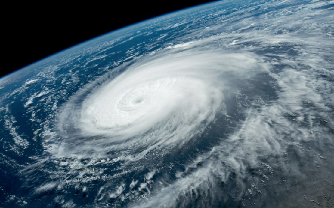
China's meteorological authorities have elevated their alert status as Typhoon Dolphin moves toward the eastern seaboard, triggering one of the country's most comprehensive disaster-response activations in recent months. On Saturday, the National Meteorological Centre upgraded the emergency response classification to Level III and increased the typhoon warning from yellow to orange, signalling an expectation of severe weather conditions across multiple provinces. The system represents a significant step up the government's four-tiered alert mechanism, with only Level I and II remaining as higher categories of severity.
The storm system is forecast to make landfall between Zhoushan in Zhejiang Province and Fuding in Fujian Province sometime from late Sunday night through the early hours of Monday. This positioning has placed two of China's most economically significant coastal regions directly in the path of the approaching weather system. The timing and trajectory have prompted rapid mobilisation of civil protection resources, with state agencies across both provinces implementing coordinated response protocols that reflect lessons learned from previous typhoon events and the potential for cascading disasters in densely populated areas.
Zhejiang Province, home to major ports and manufacturing centres, has moved to its second-highest typhoon alert level. Authorities have strategically deployed more than 4,000 monitoring personnel to conduct systematic inspections of over 7,500 locations identified as vulnerable to secondary hazards such as mudslides and geological instability. This preventive approach acknowledges that typhoons often trigger landslides in mountainous and hilly terrain, particularly when soil saturation reaches critical thresholds. By Friday morning, the province had also suspended all ferry operations across 162 passenger routes, instructed 193 offshore construction projects to cease activities, and mandated that 474 construction vessels return to protected harbour facilities.
Fujian Province has undertaken similarly extensive precautionary measures. Authorities there suspended 40 passenger ferry routes and ordered work stoppages at 115 offshore construction sites by Saturday noon. Of particular note is the full return to port of all 1,210 registered fishing vessels operating from Fuding, a coastal city heavily dependent on marine industries. This mass recall of fishing fleets represents both an economic cost and a significant logistical undertaking, underscoring official confidence in the severity of the approaching system.
Shanghai, despite sitting north of the direct forecast track, has issued its own blue-level typhoon alert. Meteorologists have warned that the city could experience sustained strong winds and considerable rainfall over a four-day window. Transport authorities have announced selective suspensions of train services throughout the Yangtze River Delta region, one of the world's most economically productive areas. Such disruptions illustrate how a single weather system can cascade through multiple provinces and impact national economic activity across supply chains and logistics networks.
The comparative analysis provided by Xu Yinglong, chief forecaster at the National Meteorological Centre, offers important context for understanding the perceived threat level. Typhoon Dolphin is anticipated to deliver stronger winds and heavier precipitation than Typhoon Bavi, which made landfall in July. This assessment of relative intensity has clearly influenced the decision to escalate alert levels across multiple jurisdictions, as authorities seek to position resources and issue precautionary directives before conditions deteriorate.
China's weather warning framework operates on a straightforward colour-coded system that communicates risk across four levels to the general public and emergency management agencies. Red denotes the highest severity, followed by orange, yellow, and blue in descending order of concern. This system has become standardised across mainland China and allows rapid comprehension of threat levels without requiring detailed meteorological literacy. The parallel four-tier emergency response system, with Level I representing the highest activation, provides an institutional framework for coordinating the deployment of resources and the implementation of protective measures across provincial and municipal boundaries.
The coordination evident in responses across Zhejiang, Fujian, and Shanghai reflects institutional improvements in disaster management and inter-agency communication developed over decades of typhoon seasons. By activating alert systems in advance of confirmed impact, authorities aim to minimise casualties and property damage while reducing the strain on emergency services during peak crisis periods. The deployment of monitors to geological hazard zones represents a particularly sophisticated understanding of compound hazards, as secondary disasters often claim more lives than the primary weather event itself.
For regional observers, including Malaysia and other Southeast Asian nations, the Chinese response offers instructive precedent in the management of tropical cyclone threats. The region experiences similar weather systems during monsoon seasons, and the systematic approach to early warning, coordinated resource mobilisation, and protective action planning across multiple jurisdictions demonstrates principles applicable across maritime Asia. The economic costs of such precautions—including ferry suspensions, construction halts, and fishing fleet recalls—reflect a calculation that preventive measures carry lower total cost than reactive recovery efforts following disaster impact.