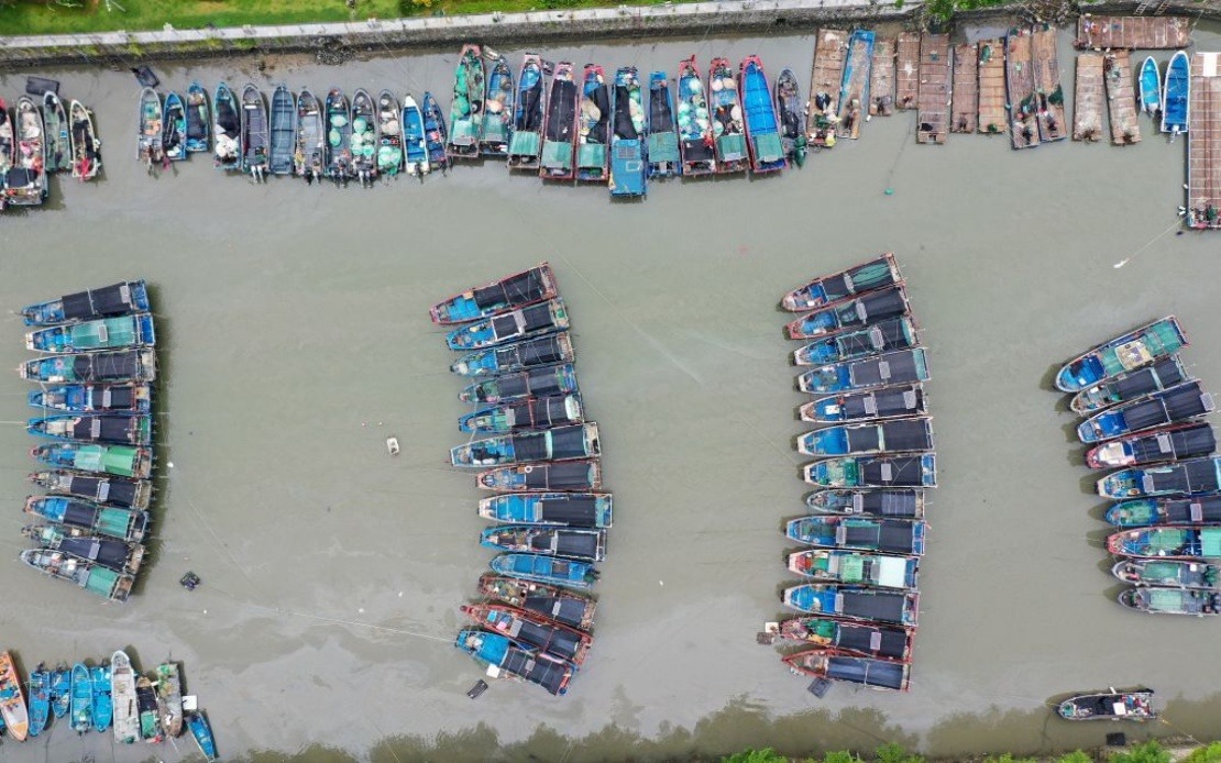
China's meteorological authorities escalated their warning level to red alert on Saturday as Typhoon Noul moved closer to the Guangdong coast, marking the activation of the most severe tier in the country's four-tiered typhoon warning system. The National Meteorological Centre (NMC) issued the alert as the 12th typhoon of the year positioned itself for an expected landfall along southern China's vulnerable coastal regions, triggering coordinated emergency responses across multiple provinces already bracing for severe weather impacts.
As evening fell on Saturday, the typhoon's centre remained approximately 100 kilometres offshore from Huidong County in Huizhou City, Guangdong Province. The system displayed considerable strength, with maximum sustained winds near its centre reaching Force 14 according to the NMC's latest measurement, indicating a particularly powerful and dangerous storm system. This intensity placed Typhoon Noul firmly in the category of major typhoons capable of causing significant damage to infrastructure, agriculture, and coastal communities across the affected regions.
The meteorological trajectory forecast by the NMC suggested that Typhoon Noul would move northwestward at approximately 20 kilometres per hour while continuing to strengthen before making landfall. Following its impact on the coast, the system was predicted to shift toward a north-northwestward course as it penetrates inland, gradually diminishing in intensity as it moves away from the warm waters that fuel tropical cyclone formation. This forecast pattern indicated an extended period of severe weather for multiple provinces rather than a brief isolated event.
In response to the escalating threat, China's State Flood Control and Drought Relief Headquarters elevated its emergency response protocols to Level III for Guangdong Province, recognising the province as the focal point of immediate danger. Simultaneously, the agency activated a Level IV emergency response for Jiangxi and Hunan provinces, indicating significant concern about secondary effects including flooding from heavy rainfall and potential riverine swelling across inland areas. These coordinated emergency declarations reflected the systemic approach authorities employ when confronting major typhoon events that threaten multiple administrative regions.
China's colour-coded warning framework classifies severe weather threats across four ascending levels of severity. The red alert designation at the peak of this system supersedes the orange alert, which itself ranks above yellow and blue warnings. The red alert's activation signals that authorities regard the approaching typhoon as posing exceptional danger, warranting immediate precautionary measures, potential evacuation protocols, and the mobilisation of emergency services infrastructure. The specificity of this tiered approach enables coordinated responses proportionate to the demonstrated threat level.
For regional observers including Southeast Asian meteorological services, Typhoon Noul's trajectory and intensification pattern carries significance beyond China's immediate borders. The typhoon's characteristics and movement influenced atmospheric conditions across the broader East and Southeast Asian region, potentially affecting monsoon patterns and creating secondary weather complications in neighbouring countries. Malaysia and other regional nations routinely monitor Chinese typhoon developments given the interconnected nature of tropical weather systems across this part of Asia.
The activation of the red alert represented a critical juncture in emergency management planning, as it typically precedes the implementation of mandatory evacuation orders, suspension of coastal transportation services, and heightened disaster preparedness mobilisation. Authorities would have begun pre-positioning emergency supplies, activating shelters, and issuing public warnings in affected coastal communities. Fishing fleets and maritime traffic would face restrictions or mandatory returns to port, and industrial operations in vulnerable areas would likely initiate shutdown procedures to protect workers and facilities.
The combination of Typhoon Noul being the 12th recorded typhoon of the year, coupled with its forecasted strengthening despite approaching cooler waters, underscored a particularly active typhoon season. This intensity of activity created cumulative stress on provincial disaster management resources, as communities in coastal Guangdong and adjacent regions had already endured multiple storm events. The frequency and strength of typhoons during hyperactive seasons like this can overwhelm local emergency response capacity if storms arrive in rapid succession.
The landfall location along Guangdong's coast represented a particularly sensitive geographical point. The province's dense population concentrations, extensive industrial infrastructure, major port facilities, and critical transportation networks converged in the coastal zone directly threatened by Typhoon Noul's path. Agricultural areas inland from the coast faced risks from torrential rainfall and flooding, while urban areas confronted the prospect of strong winds, storm surge, and major disruption to economic activity across one of China's most economically significant regions.
For Malaysian stakeholders monitoring regional weather patterns and supply chain vulnerabilities, the developing typhoon situation warranted attention given Guangdong's role as a major manufacturing and trading hub. Disruptions to port operations, logistics networks, and industrial production in the province could create ripple effects across regional commerce and shipping arrangements. Malaysian businesses with supply chain connections to Guangdong faced potential delays and logistical complications lasting days or weeks depending on storm severity and recovery timelines.