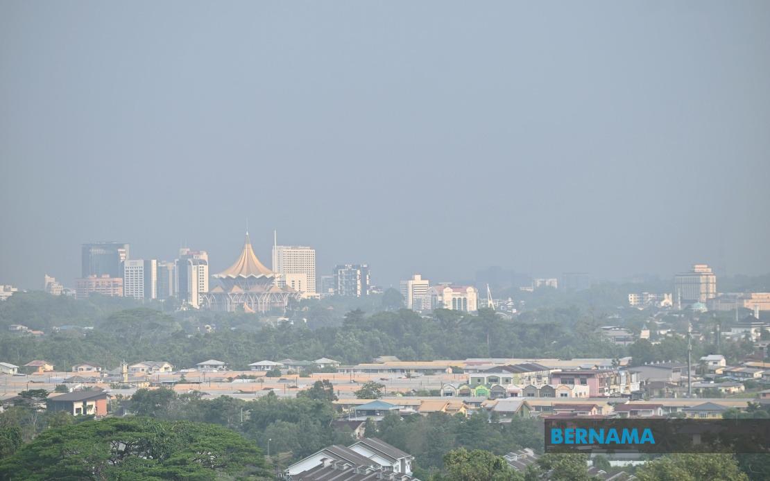
Sarawak faces an extended period of oppressive heat and dryness that is forecast to persist until August 20, according to updated warnings from the Malaysian Meteorological Department. The prolonged thermal event, fuelled by persistent southerly wind patterns and numerous fire hotspots across the Borneo region, carries significant implications for air quality and public health throughout the peninsula's eastern flank.
The combination of meteorological factors creating this weather pattern reflects seasonal atmospheric circulation patterns that typically affect Southeast Asia during the mid-year months. Southerly winds channelling warm, moisture-deficient air masses into Sarawak and surrounding areas have suppressed the formation of rain clouds, allowing solar heating to intensify ground temperatures. This dynamic, coupled with the sustained presence of hotspots—both agricultural burning and uncontrolled fires—creates a synergistic effect that degrades air quality substantially.
As of the morning of August 14, the impact on air quality was already pronounced, with ten monitoring stations across Malaysia recording Air Pollutant Index readings classified as unhealthy. The geographic concentration of these unhealthy readings in Sarawak underscores the severity of conditions in that state, where visibility degradation poses risks to aviation, maritime navigation, and road safety. The threat to southern Sarawak is particularly acute, given the region's proximity to major population centres and industrial zones.
The meteorological outlook carries important ramifications for residents and businesses in affected areas. Prolonged exposure to elevated particulate matter and air pollutants increases respiratory health risks, particularly among vulnerable populations including children, the elderly, and those with pre-existing respiratory conditions. Schools and workplaces may need to implement air quality protocols, while outdoor activities should be curtailed during peak pollution episodes.
For the broader Southeast Asian context, Sarawak's air quality challenges reflect the region's interconnected atmospheric systems and the difficulty of managing transboundary air pollution. Fire management practices in Indonesian territories, particularly Kalimantan, directly influence conditions across Malaysian Borneo, illustrating the need for coordinated regional environmental stewardship and early warning systems.
Simultaneously, meteorological forecasters issued separate storm alerts for Malaysia's northwestern peninsula, with thunderstorm and heavy rain warnings affecting Perlis, Kedah, Penang, and Kuala Lumpur through the afternoon of August 14. This contrasting weather pattern demonstrates the peninsula's geographic diversity—while Borneo experiences heat-induced haze, the northwestern regions faced potential flash flooding and lightning hazards.
The storm zone extended into multiple districts within Perak, including Kerian, Selama, Larut Matang, Manjung and Bagan Datuk, while several Selangor localities including Sabak Bernam, Kuala Selangor, Klang, Petaling, Gombak and Hulu Selangor fell under the warning umbrella. This bifurcated weather pattern reflects the monsoon transition period, when atmospheric instability in some regions coexists with high-pressure systems elsewhere.
The divergent conditions highlight the importance of localized, real-time weather intelligence for risk management. Residents and authorities in rain-affected areas require immediate notification to prepare drainage systems and secure vulnerable structures, while those in haze zones need sustained air quality monitoring to implement protective measures. The simultaneous occurrence of opposite weather extremes underscores Malaysia's complex meteorological position within the broader Asian climate system.
Public communication emerges as critical infrastructure during such weather episodes. The Malaysian Meteorological Department has directed citizens toward multiple information channels including its official website, social media accounts, and the myCuaca mobile application. This multi-platform approach acknowledges varying levels of digital access across the population and ensures that warnings reach diverse demographic groups. Timely, accurate dissemination of weather alerts directly influences public decision-making regarding outdoor activities, travel timing, and health precautions.
For policymakers and emergency managers, the extended heat wave in Sarawak presents opportunities to strengthen environmental monitoring and fire prevention protocols. Coordinated efforts with neighbouring jurisdictions to reduce hotspot activity during forecast high-risk periods could substantially mitigate air quality degradation. Similarly, the northwestern storm warnings underscore the importance of maintaining robust flood early warning systems and ensuring drainage infrastructure is prepared for intense precipitation events.
The contrasting weather conditions across Malaysia also carry economic dimensions. Haze-related visibility constraints may disrupt transportation networks and commerce in Sarawak, while flash flood risks in the northwest threaten agricultural productivity and infrastructure in vulnerable lowland areas. These cascading effects extend beyond immediate weather impacts to influence supply chains, tourism operations, and business continuity across the affected regions.
Looking forward, the meteorological situation serves as a reminder of Malaysia's vulnerability to climate-driven extremes and the importance of adaptive infrastructure and responsive governance. As global climate patterns shift, such episodes may become more frequent or intense, necessitating enhanced preparedness, improved inter-agency coordination, and investment in resilience-building measures across both environmental and public health sectors.