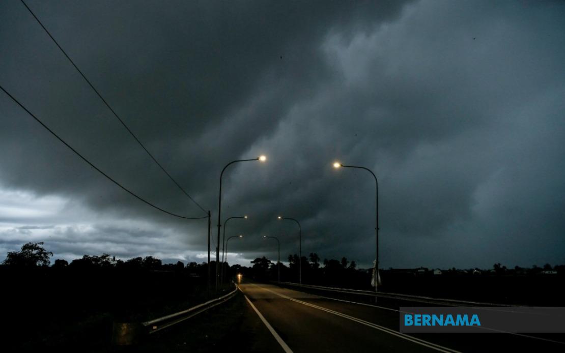
The Malaysian Meteorological Department has issued an urgent alert for thunderstorms accompanied by heavy precipitation and strong winds affecting a broad swathe of the country, with the warning remaining active until 6 pm on August 2. The alert encompasses multiple districts spanning Peninsular Malaysia, East Malaysia's Sarawak and Sabah, reflecting the scale and geographical breadth of the anticipated weather system.
In northern Peninsular Malaysia, all of Perlis faces the severe weather threat. Kedah has been placed on alert, with six districts specifically identified as at-risk zones: Padang Terap, Kuala Muda, Sik, Baling, Kulim and Bandar Baharu. Perak's alert extends across ten administrative divisions, including Kerian, Larut, Matang and Selama, Hulu Perak, Kuala Kangsar, Kinta, Kampar, Batang Padang and Muallim, suggesting a particularly extensive storm system expected to affect the state's diverse topography from coastal plains to inland highlands.
Kelantan and Terengganu in the northeast are similarly exposed, with seven Kelantan districts flagged: Pasir Mas, Jeli, Tanah Merah, Machang, Pasir Puteh, Kuala Krai and Gua Musang. Terengganu's entire state territory faces the warning, indicating meteorologists expect widespread impacts across the region. In Pahang, eight districts have been identified as vulnerable: Cameron Highlands, Lipis, Raub, Jerantut, Bentong, Kuantan, Pekan and Rompin, a configuration that suggests the storm system may track inland across Peninsular Malaysia's central mountain ranges and eastern lowlands.
The central zone sees more limited exposure, with only Hulu Selangor in Selangor placed under alert. However, Johor's southern position brings seven districts into the warning zone: Batu Pahat, Kluang, Mersing, Pontian, Kulai, Kota Tinggi and Johor Bahru. The distribution across Johor indicates the storm system may push toward Malaysia's southern extremity, potentially affecting major population and economic centres in the state.
Sarawak faces substantial impacts, with alert zones spanning the state's western and central regions. Kuching division includes Bau and the main urban centre, while Betong encompasses Saratok and Kabong. Additional alerts cover Sarikei, Sibu and Selangau, Mukah, Bintulu, and Miri division incorporating Subis, Beluru, Miri and Marudi. Limbang in the state's northern border region is similarly affected. This geographical spread suggests a complex weather pattern influencing Sarawak's entire territory.
Sabah's exposed zones concentrate in specific regions: the Interior encompasses Sipitang, Tenom, Kuala Penyu, Beaufort and Tambunan; the West Coast faces blanket coverage; Sandakan's Beluran district is flagged; and Kudat in the north is included. The pattern suggests storm systems may approach Sabah from multiple directions simultaneously, a scenario consistent with tropical monsoon or frontal systems common during Malaysia's southwest monsoon season.
The scope of this alert—covering districts from Perlis in the far north to Limbang in Sarawak's northern reaches, and encompassing both Peninsular Malaysia's developed corridors and East Malaysian interior zones—reflects significant atmospheric instability across the entire Malaysian territory. Such widespread alerts typically accompany major pressure systems or monsoon surges that can produce dangerous localised phenomena including flash flooding, wind damage and lightning strikes.
Residents across these jurisdictions should remain alert to rapidly changing conditions. The concentration of alerts across multiple coastal and lowland areas raises particular concern about flash-flooding potential in urban zones and river valleys. Drivers navigating between affected districts should exercise heightened caution, particularly on routes traversing Peninsular Malaysia's east-west corridors where afternoon thunderstorms can develop rapidly. Communities in Cameron Highlands, interior Sarawak and Sabah's highland zones should monitor stream and river levels given the convergence of heavy rainfall with topographical factors that accelerate water runoff.
The six-hour warning window suggests meteorologists anticipate the most severe conditions concentrating during afternoon and early evening hours, when atmospheric heating typically peaks and storm development intensifies. This timing aligns with typical diurnal convection patterns across Malaysia's maritime tropical environment. Residents should secure loose outdoor objects, avoid open water bodies and electrical appliances during the storm's passage, and monitor official weather updates for any extension or intensification of the alert.
The breadth of this alert underscores the dynamic and occasionally severe nature of Malaysian weather systems, particularly during monsoon transitions. While thunderstorms constitute routine occurrences across the region, alerts spanning such extensive geographic areas and encompassing multiple states simultaneously warrant serious preparation measures from both individuals and emergency management authorities. Business continuity planners and transport operators should consider potential disruptions to normal schedules and implement contingency protocols, particularly affecting routes connecting affected urban and commercial zones.