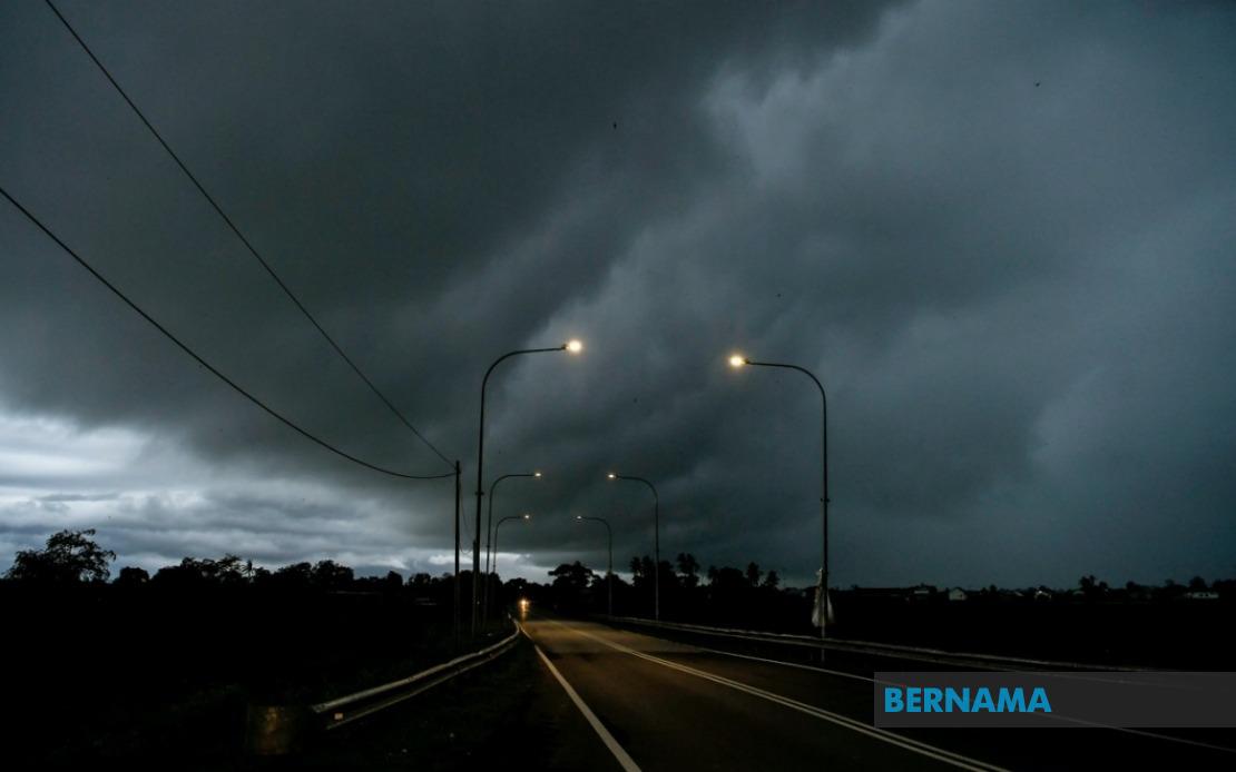
The Malaysian Meteorological Department issued an urgent weather alert on June 18 covering extensive areas across Peninsular Malaysia and East Malaysia, forecasting thunderstorms accompanied by heavy rainfall and gusty winds to persist until 9 pm. The warning extends across nine states plus the federal territory of Labuan, affecting millions of residents and prompting authorities to advise caution during the evening period.
Perlis faces the broadest exposure under the alert, with the entire state placed under the weather warning. Neighbouring Kedah experiences similar conditions concentrated in specific districts including the popular tourist destination of Langkawi alongside Kubang Pasu, Kota Setar, Pokok Sena, Padang Terap, Sik and Baling. The industrial heartland of Perak sees warnings confined to Kerian, Larut, Matang and Selama, Kuala Kangsar, Kinta and Kampar, though these areas encompass major population centres and economic zones.
On the east coast, Pahang residents in Cameron Highlands—a highland tourism and agricultural area—must prepare for severe weather, as must communities in Bentong, Bera and Rompin. Closer to the capital, Selangor's Hulu Langat district faces thunderstorm conditions, while in Negeri Sembilan, Jelebu and Jempol districts are affected. Johor, Malaysia's southern bastion, sees the warning apply specifically to Segamat, Kluang and Mersing, three districts spanning the state's interior and eastern regions.
East Malaysia experiences similarly broad coverage. Sarawak's alert encompasses Kuching including the suburban districts of Bau and Kuching proper, alongside Serian and Samarahan with its sub-districts of Samarahan and Asajaya. The warning extends inland to Sarikei's Meradong area, the central Sibu division, Mukah's Tanjung Manis locality, and the upriver Kapit division covering Song and Kapit. Coastal Bintulu sees its Tatau and Sebauh areas flagged, while remote Miri district includes Marudi in the northern reaches, and Limbang bordering Brunei is similarly affected.
Sabah's vast territory receives comparable attention, with alerts covering interior regions including Sipitang, Kuala Penyu, Beaufort and Tambunan—areas prone to landslides and flash flooding during heavy downpours. The densely populated west coast faces exposure, while Sandakan division's Tongod and Kinabatangan districts, home to significant communities and natural reserves, are included in the warning. Labuan, the offshore financial centre, completes the affected zones.
Thunderstorm warnings of this scale and geographic span typically reflect significant atmospheric instability and moisture convergence, often associated with inter-monsoon transitions or low-pressure systems. For residents, such alerts necessitate practical preparations including securing outdoor items, avoiding unnecessary travel during peak rainfall periods, and monitoring weather updates. Motorists should exercise heightened caution as thunderstorms reduce visibility and roads become hazardous, particularly on highways connecting these regions.
The meteorological department's decision to specify affected districts rather than blanket state-wide warnings reflects increasing precision in forecasting. This targeted approach allows local authorities and residents to concentrate preparations and resources efficiently. Given Malaysia's tropical climate and geographic positioning, such weather systems occur regularly during transition seasons, yet their unpredictability demands continuous monitoring from MetMalaysia's sophisticated detection networks.
Businesses and event organisers across these regions must factor the warning into operations. Industries sensitive to weather disruptions—including palm oil transport, port operations and tourism activities—should adjust schedules accordingly. Agricultural communities, particularly in highland areas like Cameron Highlands, remain vigilant about soil stability and crop protection. Schools and public institutions may need contingency plans if the severe weather persists beyond initial forecasts.
Public safety agencies across all nine states have likely mobilised resources in anticipation of weather-related emergencies. Flood management authorities typically increase patrols in flood-prone zones, while fire and rescue services prepare for callouts involving fallen trees, vehicle accidents and structural damage. The evening timeframe means commuters and evening activity planners should anticipate disruptions to traffic flow and public transport services, particularly in urban corridors.
Malaysian residents familiar with tropical weather patterns recognise that such warnings, while attention-demanding, represent the meteorological service's commitment to public safety through timely communication. The specificity regarding timing—ending at 9 pm—suggests forecasters project the system's passage or intensity reduction around that window, though conditions can sometimes persist longer. Those in affected areas should remain alert to official updates from MetMalaysia and local disaster management channels throughout the afternoon and evening, adjusting plans as conditions evolve.